
The Missouri Health Data Map Room hosts more than 30,000 mappable data layers. With data spanning topics such as demographics, income, education, health, and housing, the Map Room supports planning, decision-making, and funding requests and can help you explore issues and opportunities in your community.
Search and Add Layers
Explore Your Map
Customize Your Map
Share, Download, & Save
Step 1 – Search and Add Layers
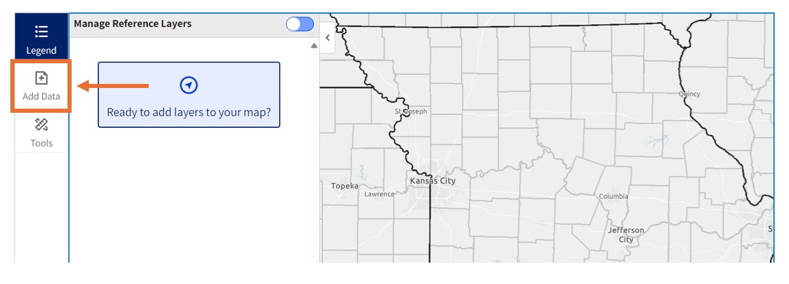
Begin by searching for data layers to add to your map.
–> Search for data layers by typing one or two keywords into the search bar. Try keywords such as food, poverty, hospital, housing, graduation rate, and health insurance to get started.
Click the “Browse by Topic” or “Browse by Source” buttons to explore data by category and source.
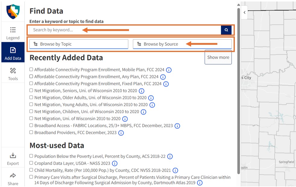
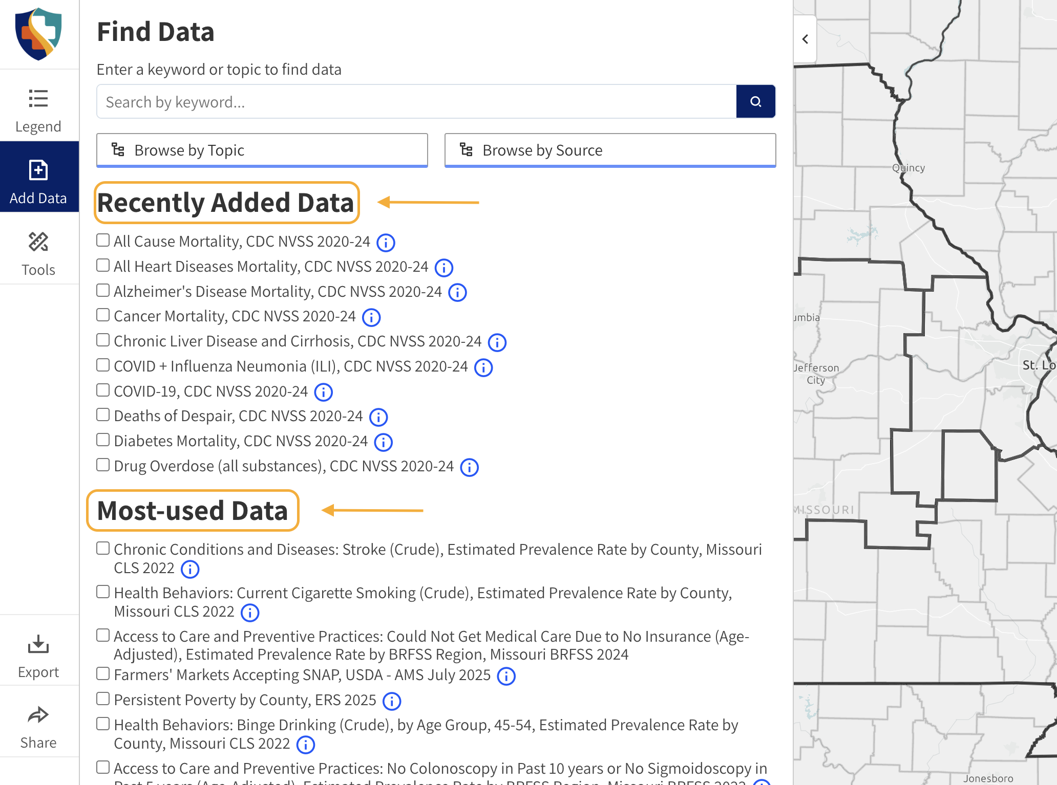
You can also select data layers from the “Recently Added” and “Most-Used” data lists.
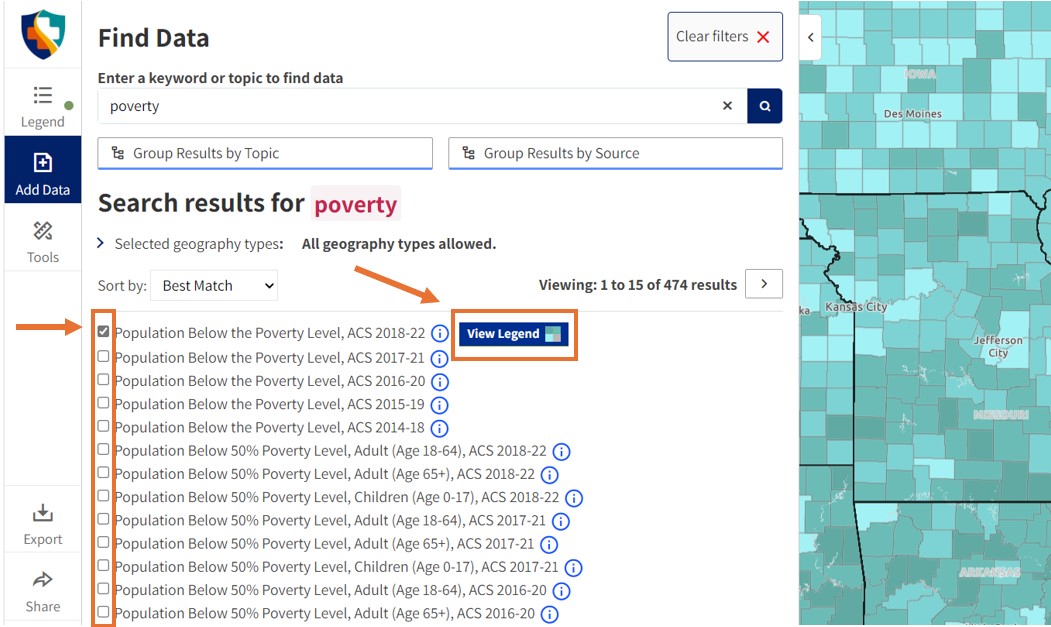
–> Add layers to your map by clicking the checkbox next to the layer name. The layer will automatically load on your map.
–> Click the “View Legend” button.
Step 2 – Explore Your Map
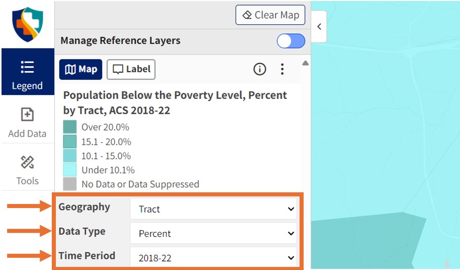
–> Click the “Legend” button to open and close the legend. Use the drop down menus to change geographies, data types, and time periods (where available).
Use the opacity slider to adjust the transparency of the data layer.
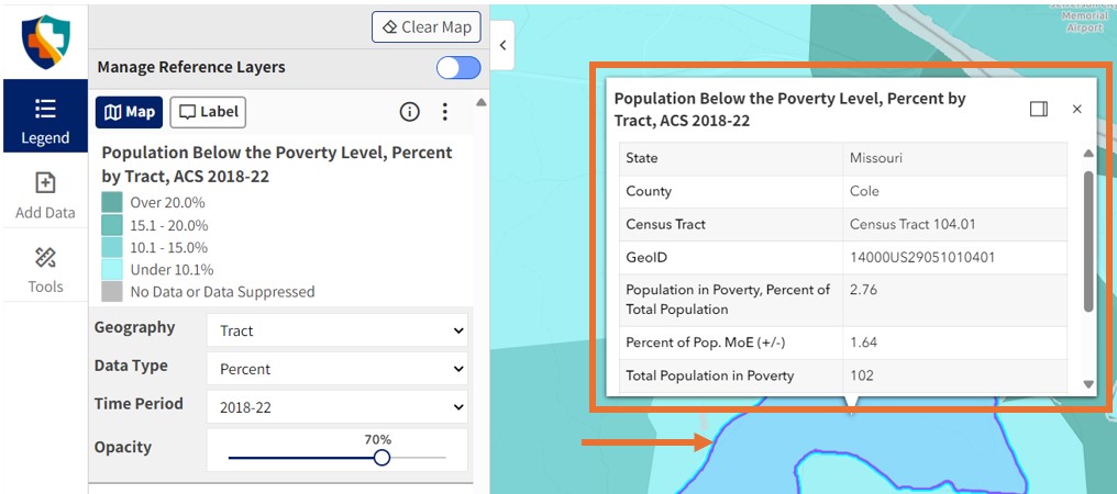
–> Click anywhere on the map to view data. A pop up window will appear with more information.
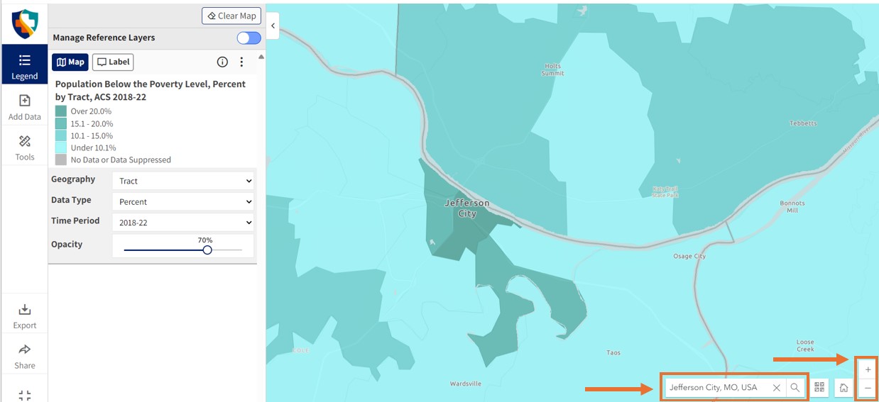
Zoom in and out using the + and – buttons in the bottom right corner of the Map Room. Use the location search bar on the bottom right to search for a specific county, town, ZIP code, or address.
Step 3 – Customize Your Map
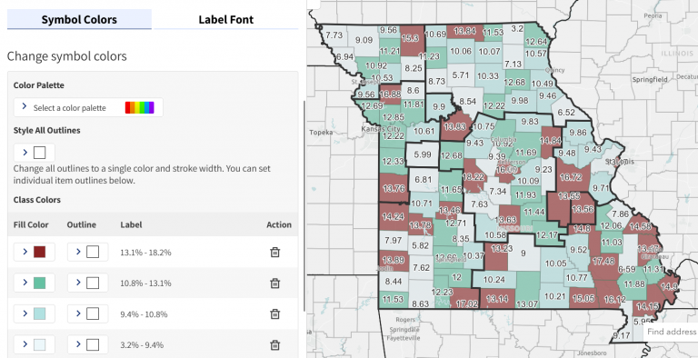
–> Click the paint bucket in your legend pane to open the map customizer tool.
–> Update your map’s colors by selecting from standard color ramps or creating your own, custom styles.
–> If labels are displayed, use customizer to change size, color, and font.
For additional help with the map customizer, see the full tutorial at https://careshq.org/map-room-customization/
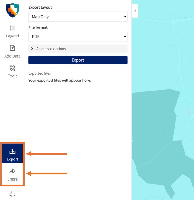
–> Click the “Share” button in the left menu to share your map via email, social media, or as a dynamic shortlink.
–> Click the “Export” button in the left menu to export or download your map as an image.
Need assistance? Email us at help@cares.missouri.edu